This presentation given at the TEDx- Rainer this past December discusses several different technologies Microsoft Research is utilizing to better provide data visualization to the world.
While the term "GIS" is never directly used during the presentation, it is apparent in every aspect of what they are doing. However sometimes this little fact can be overlooked, with non GIS-professionals not realizing that the data and tools which they are using are being powered behind the scenes by GIS nor the complexities involved in creating some of the products which are available everyday because of the work of data custodians, database administrators, analysts, and many other geospatial professionals. Make sure to highlight these behind the scenes facts to your coworkers, peers, and decision makers to help them better understand the power of what we do.
Wednesday, September 28, 2011

Wednesday, September 21, 2011
Its Conference Time Again
It seems that this time of year all of our regional workshops and conferences kick into gear giving GIS professionals the opportunity to show all of the great projects and techniques they have worked on over the past year and bring everyone together to create those highly valuable networking opportunities.
This past week the 5th Annual CFGIS workshop was held in Daytona Beach, FL. It was well attended and gave GIS users the opportunity to learn new skills, learn from their peers, and enhance their network of GIS professionals. This was the first of many workshops and conferences that will be coming to Florida this year. Presentations from the CFGIS Workshop will be available soon on the workshop's website. Click here to view.
The next regional conference, the South Florida GIS Expo will be held on October 6th & 7th at the Palm Beach Convention Center. Registration is free and attendance is highly encouraged, click here for more information.
For the north Florida GIS users, the Seven Hills Regional Users Group (SHRUG) workshop will be held November 9th and 10th in Tallahassee, FL. Click here to learn more.
Other conferences such as GIS in Transit held in St. Petersburg, FL last week as well as the 25th annual FACM conference to be held in Bonita Springs, FL next month are great examples of how actively Florida associations are making available educational opportunities for the state GIS community.
FLURISA the Florida chapter of URISA is actively working to bring many great things to the GIS community. Included in this effort, FLURISA members have been contributing at each of the conferences with presentations and holding special meetings to make the GIS community even stronger. If you are not yet a member, click here. Registration is free for the next year and you don't want to miss all of the great things that will be coming for members only!!!
Hopefully, each of us throughout the Florida GIS community will be able to take advantage of one or more of these great opportunities. Stay tuned for all of the great things still to come!!!
This past week the 5th Annual CFGIS workshop was held in Daytona Beach, FL. It was well attended and gave GIS users the opportunity to learn new skills, learn from their peers, and enhance their network of GIS professionals. This was the first of many workshops and conferences that will be coming to Florida this year. Presentations from the CFGIS Workshop will be available soon on the workshop's website. Click here to view.
The next regional conference, the South Florida GIS Expo will be held on October 6th & 7th at the Palm Beach Convention Center. Registration is free and attendance is highly encouraged, click here for more information.
For the north Florida GIS users, the Seven Hills Regional Users Group (SHRUG) workshop will be held November 9th and 10th in Tallahassee, FL. Click here to learn more.
Other conferences such as GIS in Transit held in St. Petersburg, FL last week as well as the 25th annual FACM conference to be held in Bonita Springs, FL next month are great examples of how actively Florida associations are making available educational opportunities for the state GIS community.
FLURISA the Florida chapter of URISA is actively working to bring many great things to the GIS community. Included in this effort, FLURISA members have been contributing at each of the conferences with presentations and holding special meetings to make the GIS community even stronger. If you are not yet a member, click here. Registration is free for the next year and you don't want to miss all of the great things that will be coming for members only!!!
Hopefully, each of us throughout the Florida GIS community will be able to take advantage of one or more of these great opportunities. Stay tuned for all of the great things still to come!!!
Tuesday, August 16, 2011
CFGIS July 29th IGNITE presentations
CFGIS held its July 29, 2011 Users Group a few weeks ago and we are very happy to say that we had over 100 attendees taking advantage of the great program. We wanted to share with you two CFGIS Ignite presentations in case you were unable to make the meeting or just wanted to see them again.
Thursday, July 28, 2011
The world of Social Media
This article shows the world usage of Flickr and Twitter.

"Sometimes it’s very easy to forget just how quickly the world changes, particularly with the all-conquering innovations that develop on the internet.
After all, it’s just five years ago that Twitter first opened its doors to an unassuming public, and nobody could have begun to imagine the impact that the network would make around the globe – culture to culture, person to person – in such a short space of time.
These incredible maps, created by Eric Fischer, use geolocation to show how both Twitter and photo-sharing service Flickr are spreading across the planet.
The locations of tweets are detailed in blue, while those from Flickr are in red/orange. White dots show locations that have been posted to both."
Wednesday, July 6, 2011
Before and After Aerial of the Minot River Flooding in North Dakota

Thursday, June 16, 2011

Thursday, June 9, 2011
East Central Florida Regional Atlas is Now Live
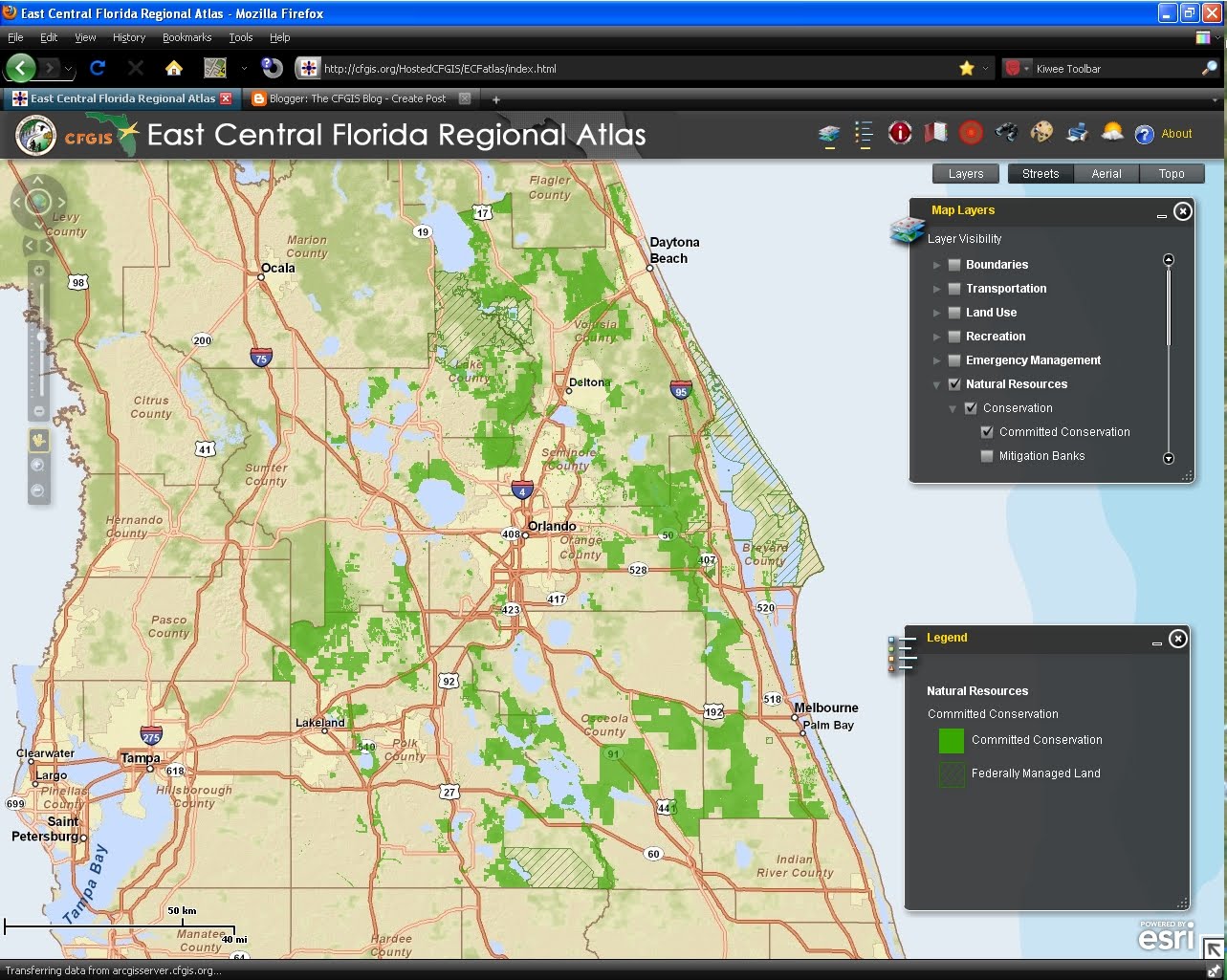
CFGIS is proud to announce the launching of the East Central Florida Regional Atlas. This interactive map, developed by the ECFRPC, contains many different regional datasets that are available for download in the CFGIS clearinghouse. Several additional tools are available including: Search, Draw & Measure, and Find an Address.
Click Here to check out the new Regional Atlas.
Subscribe to:
Posts (Atom)